Mount Everest sits on the Nepal-China border in the Mahalangur Himal sub-range of the Himalayas, at approximately 27.99 degrees N, 86.92 degrees E, with an official height of 8,849 m confirmed by a joint Nepal-China survey in 2020. The Nepal side falls inside Sagarmatha National Park in the Khumbu region; the north side sits in the Tibet Autonomous Region of China. Nepal calls the mountain Sagarmatha; Tibetans call it Chomolungma. Passang Dawa Sherpa, who was born in Phortse in the Khumbu at 3,840 m and leads this company's Everest Base Camp departures, wrote this explainer for the geography questions that come up before every trip.
The sections below cover the exact border position, how the 2020 height survey changed the long-used 8,848 m figure, and how the location trekkers actually visit differs from the summit itself.
In this guide 6
- 01 Where exactly is Mount Everest located?
- 02 What are Mount Everest's exact coordinates?
- 03 Where does Everest rank among the world's continental high points?
- 04 How tall is Mount Everest, and why did the height change?
- 05 Does the standard Everest Base Camp trek actually reach the summit location?
- 06 How do trekkers actually reach the Everest region?
Where exactly is Mount Everest located?
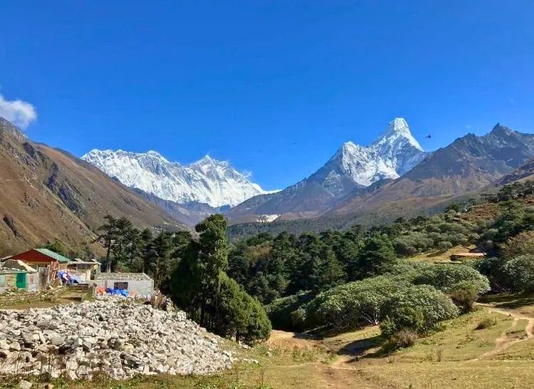
Mount Everest straddles the border between Nepal and the Tibet Autonomous Region of China, in the Mahalangur Himal, a sub-range of the Greater Himalayas roughly 160 km northeast of Kathmandu. Its summit ridge is the actual international boundary line, so a climber standing on top has one foot's width of choice about which side of the line to stand on, though in practice the two governments treat the summit point itself as shared. On the Nepal side, the mountain sits inside Sagarmatha National Park, a UNESCO World Heritage Site since 1979 that also protects Ama Dablam, Lhotse, and Cho Oyu within the same park boundary.
The nearest major town on the Nepal side is Namche Bazaar at 3,440 m, roughly 35 km south of the summit by trail, and it's the last real supply and communications hub before the high Khumbu. Everest is not the tallest mountain measured base to peak, that title belongs to Mauna Kea in Hawaii when measured from the ocean floor, but it is the highest point above sea level on Earth, which is the measurement everyone actually means when they call it the world's highest mountain.
What are Mount Everest's exact coordinates?
Mount Everest's summit sits at approximately 27.9881 degrees north latitude and 86.9250 degrees east longitude, a fixed geographic point that shows up consistently across national mapping agencies despite small rounding differences between sources. That coordinate places it almost precisely on the watershed line separating rivers flowing into the Ganges basin to the south from rivers flowing into the Tibetan plateau's interior drainage to the north.
For a trekker planning a route rather than plotting coordinates, the more useful reference point is Lukla, at 27.6869 degrees N, 86.7314 degrees E, roughly 30 minutes' flight time from Kathmandu and the actual starting point of every Everest Base Camp itinerary this site runs.
Where does Everest rank among the world's continental high points?
Everest is Asia's highest point and, by extension, the highest of the "Seven Summits," the informal mountaineering list of the tallest peak on each continent. The other six are Aconcagua in Argentina for South America, Denali in Alaska for North America, Kilimanjaro in Tanzania for Africa, Elbrus in Russia for Europe, Vinson Massif for Antarctica, and either Puncak Jaya or Kosciuszko for Australia/Oceania depending on which definition of the list a climber follows, a long-running point of disagreement among Seven Summits climbers that doesn't affect Everest's own position at the top of the list. Completing all seven is a recognized mountaineering goal, and Everest is by a wide margin the hardest and most expensive of the seven to climb, since the other six range from strenuous hikes to moderate technical climbs rather than full high-altitude expeditions.
How tall is Mount Everest, and why did the height change?
Mount Everest's official height is 8,849 m, set by a joint Nepal-China survey announced in December 2020 after both countries' survey teams independently measured the peak and reconciled their results. Before that survey, 8,848 m had been the standard cited figure since a 1955 Indian survey, and it remained the figure most commonly printed in guidebooks, textbooks, and older trip literature for over six decades. The 2020 figure accounts for snow depth and modern GPS/GNSS measurement rather than older triangulation methods, and it's now the figure used in this site's own trip pages and by most current mapping sources; if you see 8,848 m still in circulation, it's almost always a pre-2020 source rather than an error, not a genuine ongoing disagreement about the mountain's height.
Does the standard Everest Base Camp trek actually reach the summit location?
No. The standard Everest Base Camp trek that this site runs ends at Everest Base Camp, 5,364 m on the Nepal (south) side, which is roughly 3,485 vertical metres below the 8,849 m summit and a genuinely different undertaking entirely. Base Camp is a trekking destination reachable on foot by a fit hiker with no climbing or mountaineering skill required; the summit is reached only by roped, oxygen-assisted technical mountaineering that takes a separate, much longer, much more dangerous expedition. Kala Patthar, a nearby viewpoint at roughly 5,545 m that most Base Camp itineraries also climb, is the closest most trekkers ever get to an actual unobstructed view of the summit, since Base Camp itself sits in a position where Everest's summit pyramid is partially hidden behind the shoulder of Nuptse.
This distinction matters because Base Camp trekking and Everest summit climbing get conflated constantly in casual conversation and search results, and they carry entirely different risk profiles, costs, and skill requirements. A trekker who books an Everest Base Camp trek with a company like ours never enters the altitudes or terrain that make summit climbing dangerous.
How do trekkers actually reach the Everest region?
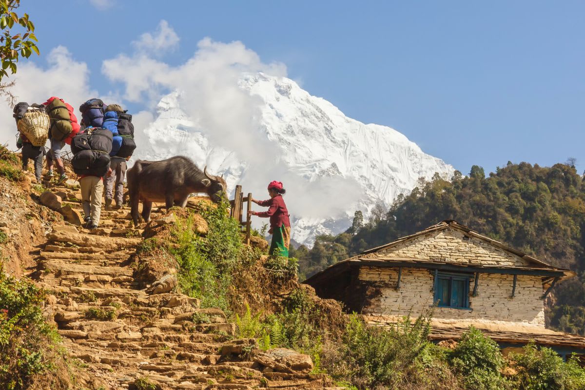
Nearly every Everest region trek starts with a roughly 30-minute flight from Kathmandu, or from Ramechhap during peak season, to Tenzing-Hillary Airport in Lukla at 2,860 m, the region's only scheduled air gateway. From Lukla, the trail follows the Dudh Koshi river valley north through Namche Bazaar and on toward Base Camp, gaining altitude gradually enough to allow acclimatization along the way. There's no road access into the Khumbu at all; the flight to Lukla, or a multi-day walk-in from Jiri on the historic original approach route, are the only ways in.
FAQ
Common questions
Is Mount Everest in Nepal or China?+
Both. Mount Everest sits directly on the Nepal-China border, with its summit ridge forming part of the boundary line. The Nepal side falls within Sagarmatha National Park in the Khumbu region; the north side sits in the Tibet Autonomous Region of China. Most trekking and climbing expeditions, including every trip this site runs, approach from the Nepal side.
How tall is Mount Everest exactly?+
8,849 m, per a joint Nepal-China survey announced in December 2020. The previous widely-cited figure, 8,848 m, came from a 1955 Indian survey and remained standard for over six decades before the newer measurement.
What is Mount Everest called in Nepali and Tibetan?+
Sagarmatha in Nepali, and Chomolungma (sometimes spelled Qomolangma) in Tibetan. The English name honors Sir George Everest, a former Surveyor General of India, though it was assigned by the Royal Geographical Society in 1865 despite both local names already being in long use.
Do you need to reach the summit to see Mount Everest up close?+
No. Everest Base Camp at 5,364 m and the nearby Kala Patthar viewpoint at roughly 5,545 m, both reachable by trekking with no climbing skill required, put you close enough for a genuine view of the mountain. The summit itself, at 8,849 m, is reached only through separate, technical mountaineering expeditions.