Nepal Travel Packages
Annapurna Circuit Trek

Annapurna Circuit Trek

★★★★★ 4.8 (187 reviews)
Annapurna, Nepal 12-16 days Strenuous Max 5,416 m
Duration
12-16 days
Max altitude
5,416 m
Difficulty
Strenuous
Group size
Up to 12
Total distance
~160 km
Elevation gain
6,200 m
Best season
March to May, October to November
Avg daily walk
5-7 hours
Starts in
Dharapani or Chame (1,860-2,710 m)
Ends in
Jomsom or Pokhara
Accommodation
Teahouse lodges throughout
✓ TAAN & NMA licensed guides ✓ Permits included, no hidden fees ✓ Small group departures
Group departure · per person
USD1,350
Permits, guide, porter, lodging & food included
Departure date
Email Nepal
Permits and logistics fully arranged
Licensed guide included on every departure
Direct WhatsApp line to your guide

The Annapurna Circuit is a 12 to 16 day teahouse trek that traverses central Nepal from the Marsyangdi valley to the Kali Gandaki, crossing the 5,416 m Thorong La, a mountain pass connecting the Manang and Mustang districts. A 2026 group departure costs USD 1,100 to 1,600 per person including the Annapurna Conservation Area Permit (NPR 3,000) and a TIMS card (NPR 2,000). Road building has shortened the classic route, so most itineraries now start at Dharapani or Chame by jeep and finish at Muktinath or Jomsom, and two acclimatization nights at Manang (3,540 m) are fixed on our departures.

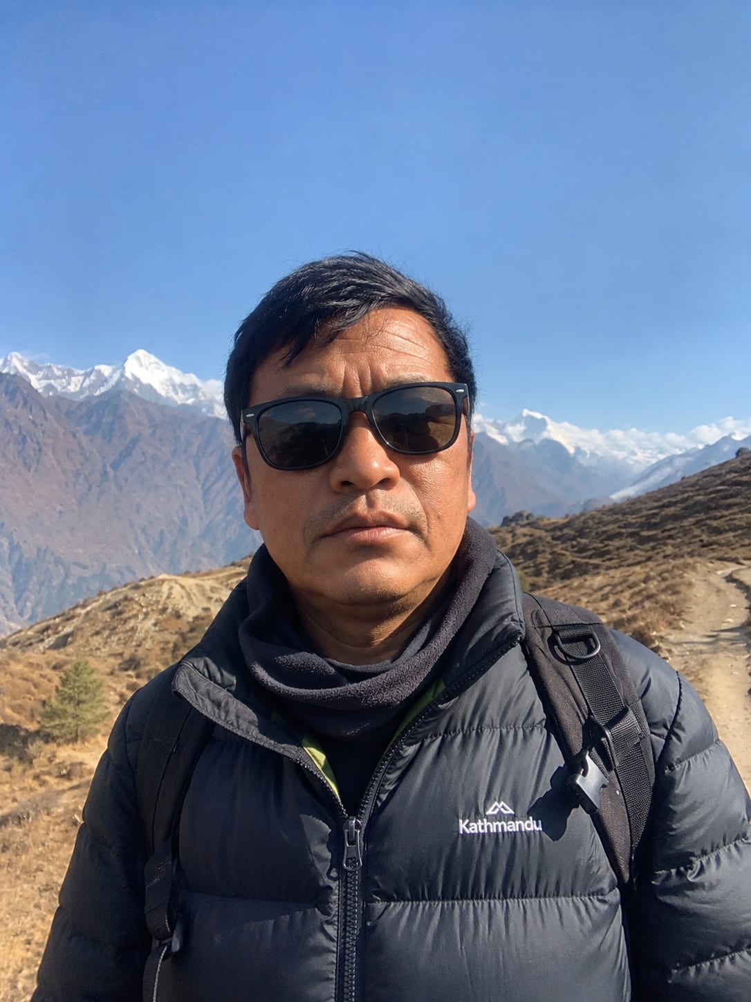
Mingma Tendi Sherpa, who has led 12 Circuit departures, wrote this page and updates its Thorong La conditions monthly in season. The sections below cover the two permits, a cost breakdown against the USD 1,100 to 1,600 range, the road-transfer reality by section, and the pass-day timing that decides a safe crossing.

Highlights

What our guides know that others don't.

1

Road-transfer reality

Jeep road now reaches Manang; most itineraries start at Dharapani or Chame

2

Thorong La crossing window

3-4 am start from High Camp; pass closes to afternoon wind

Live from the trail

Updated 2 Jul 2026

Monsoon status: lower valley wet, pass approach clear

Monsoon rain is falling on the Marsyangdi below Chame with active leeches to Dharapani. The Thorong La approach above Manang stays dry most afternoons, but we do not run scheduled Circuit departures in monsoon because of the wet lower half. Next scheduled departure: early October.

How does the Annapurna Circuit compare to Manaslu and Everest Base Camp?

The Circuit, Manaslu, and Everest Base Camp are the three routes trekkers most often compare when picking a first major Himalayan trek, and each has a genuinely different profile rather than being interchangeable options. The Manaslu Circuit crosses a higher pass, the 5,106 m Larkya La, on a restricted-area route with fewer lodges and more remote logistics, while Everest Base Camp involves the Lukla flight and its own weather-delay risk that the Annapurna Circuit avoids entirely by starting overland from Kathmandu.

Cost reflects these differences directly: the Circuit's USD 1,100-1,600 group range sits below Manaslu's USD 1,500-2,100 (Manaslu's restricted permit and more remote crew logistics drive the gap) and below Everest Base Camp's USD 1,200-1,800 (the Lukla flight itself). For a first-time high-altitude trekker choosing between the three, the Circuit's road access at both ends and simpler two-permit system make it the most straightforward to arrange, without giving up a genuine high pass crossing or a full multi-week Himalayan experience.

What permits does the Annapurna Circuit require?

Two permits cover the Circuit in 2026: the Annapurna Conservation Area Permit at NPR 3,000 and a TIMS card at NPR 2,000. Both are issued at the Nepal Tourism Board offices in Kathmandu and Pokhara, take Nepali rupees and two photographs, and are checked at ACAP posts in Dharapani, Chame, and again near Jomsom. No restricted-area permit applies to the standard Circuit, which keeps its paperwork simpler than Manaslu or Mustang.

The TIMS card ties to the licensed-guide rule that has governed Annapurna routes since 2023. How that rule works and where solo travel still stands sits in the solo trekking guide requirement guide, and the full permit map for every Nepal region is in the Nepal trekking permits master guide.

How much does the Annapurna Circuit cost in 2026?

TAAN-registered operators quoted USD 1,100 to 1,600 for a group Circuit departure in 2026, below the Everest bands because no Lukla flight is involved. The table shows where the money goes, and the largest variable is transport: a shared jeep to the Dharapani road head costs a fraction of a mountain flight, while a Jomsom-to-Pokhara flight at the end adds USD 120 per person over the bus.

The route's length rather than its altitude drives the guide and porter cost, since a 14-day Circuit pays more staff-days than a shorter trek. Water and food prices climb steadily toward Thorong Phedi, where a lodge dal bhat can reach NPR 1,000, so budget the upper end of the food line for the high sections. A private departure at USD 1,400-2,000, run on its own schedule with a dedicated guide, is the tier this site curates into its Luxury Nepal Travel Packages.

Where the price goes · per person
Permits (ACAP + TIMS)NPR 5,000 total at 2026 rates$38
Kathmandu-Dharapani/Chame jeep + Jomsom-Pokhara transferShared jeep; flight Jomsom-Pokhara adds USD 120$90–160
Licensed guide (shared in group)USD 35-40/day for a longer route$320–440
Porter, one per two trekkersUSD 25/day, 20 kg shared load$220–300
Teahouse room, 12-14 nightsNPR 400-1,200/night, higher at Thorong High Camp$55–120
Food and drinking waterPrices climb toward Thorong Phedi$260–400
Company margin, logistics, staff equipment$120–240

How has the road changed the Annapurna Circuit?

A jeep road now reaches Manang from the Marsyangdi side and climbs from Beni toward Muktinath on the Mustang side, which has shortened the classic three-week Circuit to 12 to 16 walking days. Most operators, including us, start with a jeep to Dharapani (1,860 m) or Chame (2,710 m) to skip the dusty lower road sections, then walk the high, road-free core from Chame over the Thorong La to Muktinath. This is the road-transfer reality competitors gloss over: the Circuit is still a superb high traverse, but the trail-only purist version below Chame is largely gone.

Trekkers who want to avoid vehicles entirely can walk the lower sections, adding three to four days, though the road traffic makes it a poorer experience. The high crossing itself remains untouched by roads, which is why the Manang-to-Muktinath core is the part every itinerary protects.

The practical upshot for planning: the Circuit today is best understood as a high-altitude traverse bookended by short road transfers, not the continuous three-week trail walk it was before the roads arrived. This isn't a downgrade so much as a different trek than the one described in older trip reports, and being upfront about it, rather than selling a "pure" Circuit experience that no longer exists on the ground, is part of why our itinerary descriptions state the jeep sections plainly rather than glossing over them.

What is the cost of a safe Thorong La crossing?

The Thorong La at 5,416 m is a 1,000 m ascent from Thorong High Camp (4,850 m) followed by a 1,600 m descent to Muktinath, making pass day the hardest single day on the Circuit. Our crossings start at 3 to 4 am so the group is over the top before the afternoon wind builds, a timing rule that has kept our departures incident-free. The two acclimatization nights at Manang are what make the crossing safe; skipping them is the most common reason trekkers turn back at High Camp.

Altitude, not the climb itself, is the risk on pass day, and our guides log oxygen saturation each morning above Manang. Symptoms, the descent protocol, and acetazolamide guidance sit in the altitude sickness prevention guide. In heavy snow the pass can close for a day or two, which is why our itineraries carry a contingency night at Manang.

When is the best time for the Annapurna Circuit?

October to November and March to May are the two windows we run scheduled departures, with autumn giving the most stable Thorong La conditions and spring bringing warmer nights and rhododendron blooms below Chame. Winter closes the pass for stretches when snow builds on the High Camp approach, and the monsoon makes the lower Marsyangdi wet and leech-active. Trekkers set on winter or monsoon dates are better served by rain-shadow Mustang.

Autumn is busiest at the Manang lodges, where better rooms go to groups whose guides phoned ahead. For winter Circuit planning and the pass-closure pattern, see trekking Nepal in winter; for the monsoon alternative, see rain-shadow treks during monsoon.

What travel insurance does the Annapurna Circuit require?

Travel insurance with evacuation cover to at least 5,500 m is mandatory on every Circuit departure we run, since the Thorong La sits at 5,416 m and the route's remoteness on the Manang side means a helicopter is the only realistic evacuation method above High Camp. A policy without altitude-specific cover, one written for general travel rather than trekking above 5,000 m, typically excludes the exact scenario a Thorong La emergency would create, so checking the policy wording before departure matters more than the price of the premium.

Real evacuation costs, coverage tiers, and the difference between direct billing and reimbursement are covered in the helicopter evacuation insurance coverage guide. We confirm proof of a qualifying policy before finalizing any Circuit booking, the same requirement applied to every route on this site above 5,000 m.

How does the acclimatization schedule work on the Circuit?

The Circuit's acclimatization schedule follows the same 500 m sleeping-altitude rule the acclimatization schedules guide sets for every high route, with two full nights at Manang (3,540 m) as the fixed rest point before the push toward Thorong La. From Manang, the schedule deliberately slows: Yak Kharka gains only 500 m, then High Camp gains a further 800 m over a short day, keeping the group fresh rather than rushed for the pass itself. Skipping or shortening the Manang rest days is the single most common reason trekkers turn back at High Camp, more often than raw fitness.

Manang's Himalayan Rescue Association aid post runs a free daily altitude talk in season, and our guides send clients to it as part of the rest day alongside the climb-high-sleep-low excursion to Ice Lake or Gangapurna. Above 4,000 m, from Yak Kharka onward, guides log oxygen saturation twice daily and hold the authority to hold a client at Manang for an extra night or arrange a lower-altitude alternative if symptoms warrant it, a call that isn't open to negotiation regardless of the group's schedule.

The descent from Thorong La to Muktinath drops 1,600 m in a single day, which carries no altitude risk of its own but is a serious test of knees and stamina after the early pass-day start; trekking poles and a measured pace matter more on this stretch than anywhere else on the route.

What should you pack for the Annapurna Circuit?

The Circuit follows the same core packing list covered in the Nepal trekking packing list: a four-season sleeping bag rated to at least -15 C comfort for the High Camp night at 4,850 m, layered clothing, and broken-in waterproof boots. Wind protection matters more here than on shorter routes, since the Manang-to-Muktinath corridor and the pass itself are among the windiest sections of any classic Nepal trek, and a hard shell plus a buff for the descent into Muktinath's afternoon wind is worth the extra weight.

Trekking poles are close to mandatory rather than optional on this route, given the 1,600 m single-day descent from Thorong La; a spare pole basket is a small thing to pack that avoids a real problem if one snaps on the scree below High Camp.

Elevation profile High point 5,416 m
2,0002,5003,0003,5004,0004,5001,860 m1234564,850 m782,720 m9DAY
Acclimatization night High point

Day by Day

10-day itinerary, every detail planned.

Day1
Trip Day
Drive Kathmandu to Dharapani (1,860 m)
1,860m alt.

A jeep transfer of 8 to 9 hours follows the Marsyangdi upstream through Besisahar and Bhulbhule, then along the newer stretches of hill road to the Dharapani road head, skipping the dusty lower Circuit entirely. The first night sits at teahouse comfort in the Manang district's southern gateway village, with the trek's climbing still ahead.

1,860 m
Day2
Trip Day
Dharapani to Chame (2,710 m)
~5h walking16 km
2,710m alt.
Day3
Trip Day
Chame to Upper Pisang (3,300 m)
~5h walking14 km
3,300m alt.
Day4
Trip Day
Upper Pisang to Manang (3,540 m)
~6h walking17 km
3,540m alt.
Day5
Acclimatization
Acclimatization day in Manang
~4h walking
3,540m alt.
Day6
Trip Day
Manang to Yak Kharka (4,050 m)
~4h walking10 km
4,050m alt.

What's Included

Transparent, all-in pricing.

Included in your price

Permits (ACAP + TIMS)
Kathmandu-Dharapani/Chame jeep + Jomsom-Pokhara transfer
Licensed guide (shared in group)
Porter, one per two trekkers
Teahouse room, 12-14 nights
Food and drinking water
Company margin, logistics, staff equipment

Not included

Nepal entry visa fee (USD 30-125, paid on arrival)
Travel insurance with helicopter evacuation cover
Personal trekking gear and equipment
Tips for your guide and porter
Bottled drinks, wifi, and device charging at teahouses
Meals in Kathmandu outside the itinerary

Dates & prices

Upcoming departures.

Start dateEnd datePrice / personAvailability
3 Oct 202612 Oct 2026USD 1,350Guaranteed · 4 leftEnquire
17 Oct 202626 Oct 2026USD 1,350Open · 7 leftEnquire
7 Nov 202616 Nov 2026USD 1,300Open · 9 leftEnquire
10 Apr 202719 Apr 2027USD 1,300Open · 10 leftEnquire

Verified reviews

What travellers say.

4.8/5 from 187 reviews on TripAdvisor, checked July 2026

★★★★★

The 3 am Thorong La start was cold and hard but Mingma had us over the pass in bright still air while a later group turned back in wind. The two Manang days made all the difference. Honest about the road sections too, which I appreciated.

TB
Thomas Berger · Germany
4 May 2026
★★★★

Superb traverse and well organised. The jeep in to Chame was bumpy but saved two dull days on the road. Muktinath to Jomsom was windy and long, worth knowing in advance.

PR
Priya Raman · Singapore
15 Apr 2026

Why Nepal Travel Packages

Built on published proof, not adjectives.

A named, licensed guide before you book

Full name, photo, NMA or TAAN license number, and a direct WhatsApp line. The guide on the page is the guide on the trail.

Itemized pricing, not a lump sum

Permits, guide, porter, lodging, and food broken out on every trip page. You see exactly where the price comes from.

Trail conditions updated monthly

Dated field reports from the guides running the route this season, not boilerplate written once and left to go stale.

Permits handled, not hidden

Every permit fee, checkpoint, and paperwork rule is filed for you and published in the guides — no surprise admin at Lukla.

FAQ

Common questions

Do I have to walk the whole Annapurna Circuit or can I use the road?+

You can shorten either end by jeep, which is what most 2026 itineraries do: a vehicle to Dharapani or Chame at the start and a flight or jeep from Jomsom at the end. The high core from Chame over the Thorong La to Muktinath is walked, and that is the section worth protecting. Walking the lower road sections is possible but shares the route with vehicles.

How fit do I need to be for the Thorong La?+

Pass day is an 8-hour, 1,000 m ascent and 1,600 m descent at over 5,000 m, so it demands more than the rest of the Circuit. A benchmark: if you can hike 15 km with 800 m of ascent on back-to-back days, the acclimatization schedule does the rest. Altitude, not raw fitness, is what turns most trekkers back, covered in the altitude sickness prevention guide.

What happens if the Thorong La is closed by snow?+

Heavy snow can shut the pass for a day or two, and our itineraries carry a contingency night at Manang for exactly this. If the pass stays closed, the alternative is to retrace to Besisahar and drive out, or in rare cases arrange a helicopter, which travel insurance with trip-delay cover may reimburse. Guides make the crossing call each morning based on the High Camp report.

Can I add Tilicho Lake to the Circuit?+

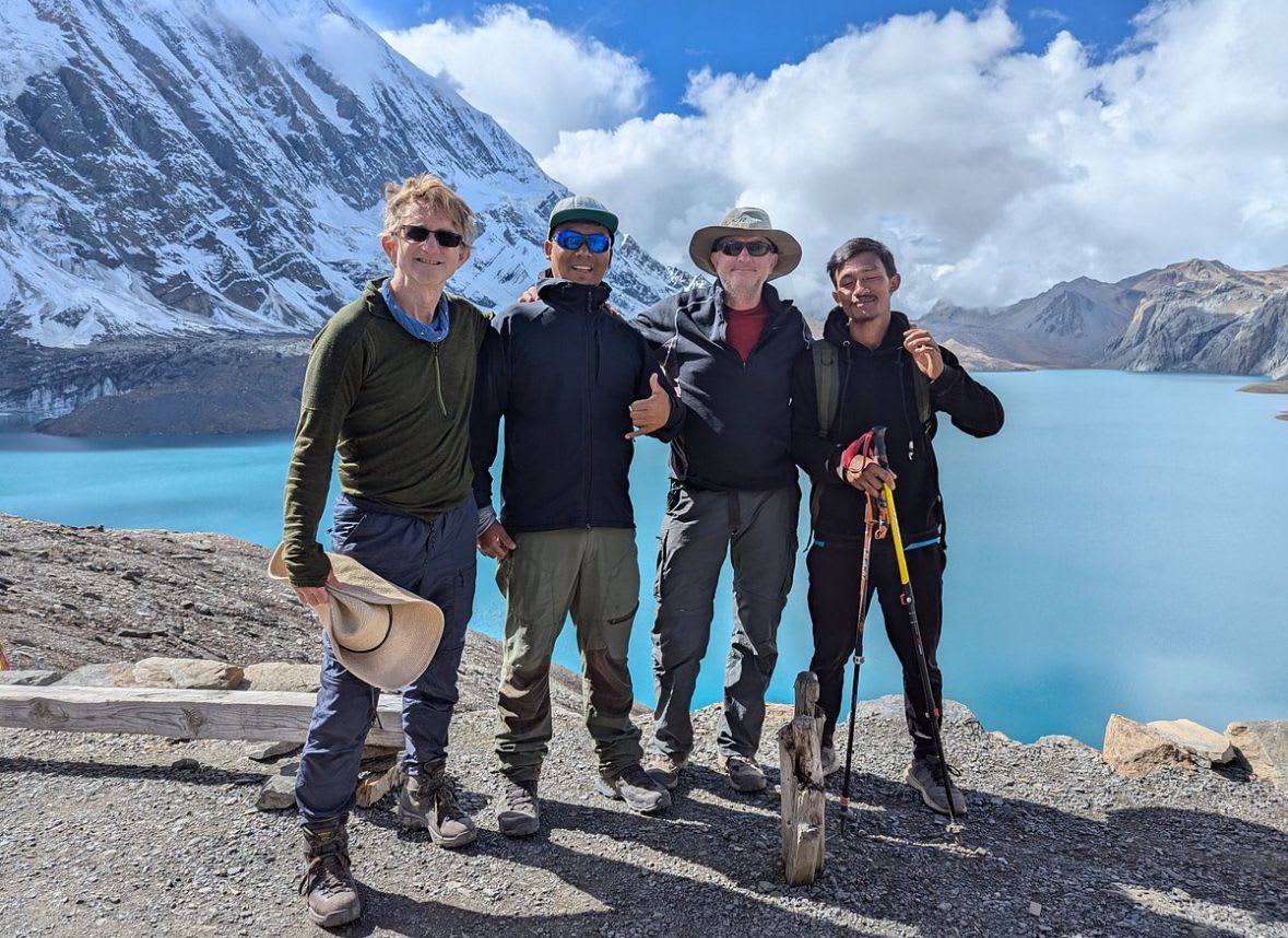
Yes, a Tilicho Lake side trip adds three to four days from Manang, reaching the 4,919 m lake often called the highest of its size in the world. It needs no extra permit but does need extra acclimatization, so we build it in only for trekkers with time and a clean altitude record on the approach.

Is the Annapurna Circuit safe for solo trekkers?+

The Circuit sits on TIMS-governed national-park routes, where the 2023 rule requires a licensed guide, so genuine solo trekking is restricted here as of July 2026. What that means in practice and cost is in the solo trekking guide requirement guide. All our departures include a licensed guide and cover the pass-day logistics.

How many rest days does the Annapurna Circuit have?+

Two full nights at Manang (3,540 m), the fixed acclimatization point before the push toward Thorong La. The schedule then slows deliberately through Yak Kharka and High Camp rather than adding a third dedicated rest day, since the ascent above Manang is already conservative by design.

How hard is the descent from Thorong La to Muktinath?+

It's the toughest stretch of the trek: 1,600 m of descent in a single afternoon after already crossing the 5,416 m pass. It carries no altitude risk, since descending is not what causes AMS, but it's a real test of knees and stamina. Trekking poles and a measured pace matter more here than anywhere else on the route.

Is the Annapurna Circuit better than Everest Base Camp for a first Himalayan trek?+

Neither is objectively better; they suit different priorities. The Circuit avoids the Lukla flight's weather-delay risk and costs slightly less, but Everest Base Camp reaches a more famous single destination. Both are strenuous, teahouse-based, and use a licensed guide. Choose the Circuit if road access and a genuine high pass matter most to you; choose EBC if standing at the base of the world's highest mountain is the priority.

What footwear is best for the Thorong La crossing?+

Broken-in waterproof hiking boots with solid ankle support, the same standard as any high Nepal trek. The pass-day terrain is loose scree and occasional early-season snow rather than technical ground, so crampons aren't standard equipment, but worn-in boots matter more here than on most routes given the 8-hour, 2,600 m combined ascent-and-descent day.

How much of the Annapurna Circuit is now road, not trail?+

Roughly the first two days each way, Kathmandu to Dharapani or Chame on the eastern side and Jomsom to Pokhara on the western side, are covered by vehicle rather than on foot in the standard itinerary. The high core from Chame over the Thorong La to Muktinath, the reason most trekkers book the Circuit, remains entirely road-free.

Can I do the Annapurna Circuit without the road sections?+

Yes, by walking from Besisahar instead of driving to Dharapani or Chame, adding roughly three to four days on trail that now shares space with jeep traffic. Most trekkers, including our scheduled group departures, skip this stretch by vehicle since the road sharply reduces its scenic value compared to the high core.

What food is available on the Annapurna Circuit?+

Standard teahouse menus, dal bhat, noodle soup, fried rice, and momos, are available at every lodge on the route, with prices climbing toward Thorong Phedi and High Camp where a dal bhat can reach NPR 1,000. Above Manang, ingredient variety thins as everything is carried in by porter or mule, so the menu narrows to the reliable core dishes rather than the wider Manang selection.

Can I charge my phone and get WiFi on the Circuit?+

Yes at most lodges, for a fee that rises with altitude, and Chame is the last reliable mobile-data town before the pass. WiFi and charging both become slower and more expensive from Manang upward, and High Camp's supply is the least reliable on the route, worth knowing if you're planning to message home before the pass crossing.

Can I do the Annapurna Circuit as a private departure?+

Yes, at USD 1,400 to 2,000 per person, run on your own schedule with a dedicated guide rather than joining a fixed group date. Pass-day timing and acclimatization days stay the same regardless of group size, since both are set by the mountain, not by how many people are booked.

Can I add extra rest days if I need more acclimatization time?+

Yes, and our guides build a spare day into every Circuit itinerary specifically for this. If you're adapting more slowly than the schedule expects, an extra night at Manang or Yak Kharka is a straightforward adjustment your guide can make on the trail rather than something that needs to be arranged in advance.

Is there an ATM on the Annapurna Circuit?+

Chame has the last reliable ATM before the pass; Manang sometimes has one running but it isn't dependable, so carry enough cash from Chame onward for lodges, food, and any extras through to Muktinath or Jomsom, both of which have banking access again after the crossing.